All photographs and scans of HALS documents shown on this website are published here with the kind permission of Hertfordshire Archives & Local Studies.
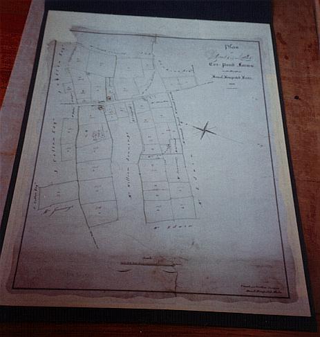
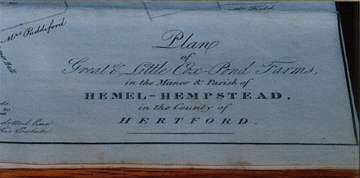
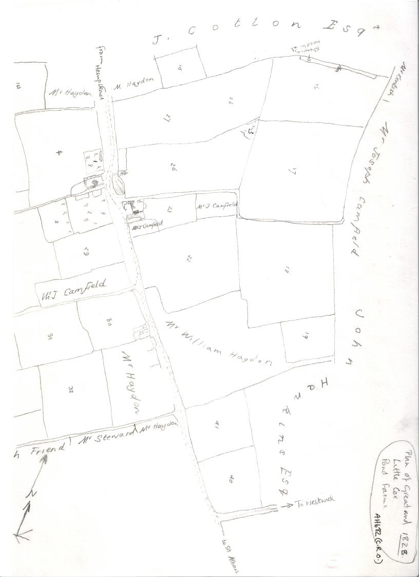
1828 - A plan of Great and Little Cox Pond Farms, surveyed by Creed & Griffin of Hemel Hempstead in this year, is held at the Hertfordshire Archive & Local Studies, County Hall, Hertford; reference AH 682. The map itself, charmingly executed shows the land belonging to the farms ( shaded in green), and the names of all the neighbouring land owners. The farms themselves were owned by the Countess of Bridgewater, although this information was not given on the plan. The farms themsleves had been auctioned the previous year, so it is likley that the plan was commissioned by the Duchess on having aquired the estate. It is also interesting to note that twelve years later in 1840, the same firm of surveyors was responsible for the Tithe survey of the area ~ namely John Griffin. The Duchess of Bridgewater was still in possession of this land at the time of the Tithe survey. The land belonging to the farm would seem to have bordered on Tile Kiln Lane, and also on Green Lane, with two separated fields running along Leverstock Green Road and Green Lane. Another point of interest is that a Lane led up the side of Little Cox Pond Farm from the Leverstock Green Road, and the wide "green" verges of the Leverstock Green Road also showed up very clearly. [ HALS AH 682]
A larger scale map of Cox Pond Farm is also held at the County Record Office. It is of a slightly later date, (possibly 1832) but in all probability preceded the Tithe map, although it has no date on it. The field numbers on this second map correspond with numbers superimposed on the previous map in faded brown ink. I conclude therefore that the original map was used to help draw up the later one. Again the names of the neighbouring landowners is shown on the map, and there are some small changes which appear. For example, a small area of land adjacent to Little Cox Pond Farm was now no longer part of the holding but owned by George Coupland. In the area next to Bunce Lane, the Reverend Kentish had increased his holdings, taking over land previously owned by Joseph Camfield. The land up nearer to Wood Lane End had also changed hands, going to John Wood and George Dines, and John Wood had also taken other land previously belonging to John Cotton on the Adeyfield side of plan.
This page was last updated on: 11 April, 2009
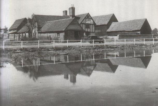
ABOVE: Great Cox Pond Farm photographed about 1925 ~ it was demolished in about 1932 for the developement of houses for the Brocks Factory workers. I beleive it to have been re-errected somewhere near Harpenden.
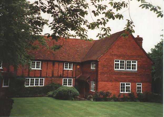
BELOW: Little Cox Pond Farm photographed by Barbara Chapman in 1994. A Grade II listed building.
HALS doc. AH 682, being a Plan of Great & Little Cox Pond Farms
1828.
Reproduced here with the kind permission of Hertfordshire Archive & Local Studies.
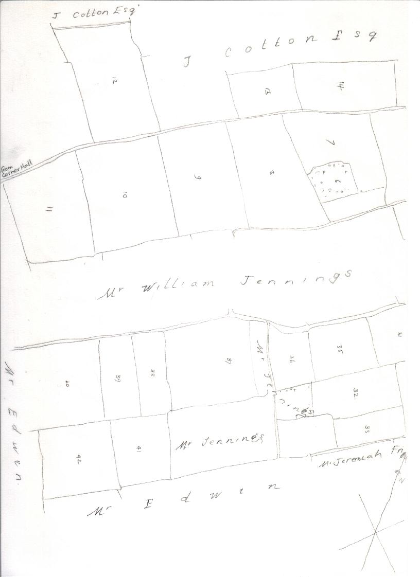
The later plan itself was not only draw to a larger scale, but also covered a slightly wider area, and used more colour. It consequently showed up an interesting feature of the roads or lanes. (See thumnail extracts from the map below.) The principle roadways were shown in brown, and this showed up very clearly the wide "greens" on either side of the road down Leverstock Green Road. It also showed that both Green Lane and Bunce Lane were totally "green" routes or tracks, with no brown road. Another interesting feature was apparent at "The Crabtree", which though not part of this farm's holding, was included on the map, as much of the land around it was. It showed very clearly that a rectangular section had been "cut" out of the road side verge to enlarge its yard or garden. This feature wsas still obvious on the 1877 25":1mile OS map. The 1828 plan also showed very clearly any buildings in the area covered by the map. [ AH 683]
Extracts from AH683, photographed by Barbara Chapman and reproduced here with the kind permission of the Hertfordshire Archives & Local Studies. - Click on images to enlarge.
Bennetts End Farm
Tile Kiln Farm
Land between Tile Kiln & Bennetts End
Green Lane & Leverstock Green (Road)
Cox Pond
Woodwells Farm
Thursday 27th September 1827 – An auction was held at 12 noon at Garraway’s Coffee House, Change Alley Cornhill, by Mr Robinson, of a large estate in Hertfordshire, part of which was a 260 acre FREEHOLD estate based upon Great & Little Cox Pond Farms. As the map which was drawn up the following year, was commissioned by the Duchess of Bridgewater who then held the estate, it can be presumed that Cox Pond Farms were added to the Bridgewater Estate (Ashridge) following the auction. [HALS AH683, AH 682]
26th July 1832 – An auction sale of the COPYHOLD of Little Cox Pond Farm took place at the Rose & Crown Inn Hemel Hempstead at 2pm. The sale was on the orders of the executors of the late Mr. Joseph Camfield, the previous copyhold owner. The estate was divided into five lots. [D/EX 7 T1] The Duchess of Bridgewater was still the Lord of the manor holding the Freehold of the estate.
Extracts from the auction leaflets, from HALS doc D/EX 7T1 reproduced here with the kind permission of the Hertfordshire Archive & Local Studies.